Part of the Oxford Instruments Group
Expand

AR Maps Software

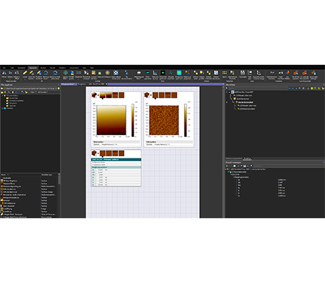
Streamline your workflow with AR Maps, a comprehensive analysis package designed for AFM data. 

Features include:

  • Extensive tools to correct, normalize, and denoise measured data
  • Characterize surface and section data including 
    • ISO standard roughness
    • Step height/measure distance
    • Histograms 
  • Develop powerful recipes to customize your data process and analysis

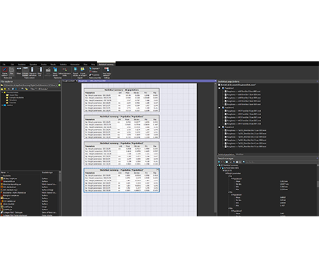
Advanced features include:

  • Batch process and automate your data analysis
  • Generate statistics reports on data sets
  • Critical dimensions and trench analysis package with cantilever tip deconvolution
  • Image stitching
  • Particle analysis

Supports both Ergo and Igor files.


Request Information Add to quote list

You may also be interested in...

Upcoming events

Latest news